Executive Summary – Minaret Parcel
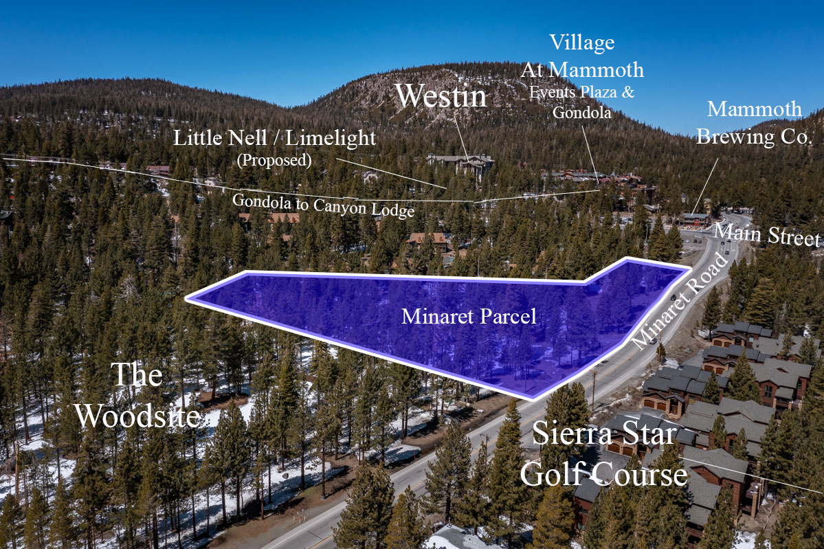
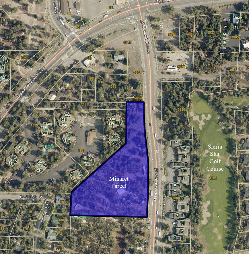
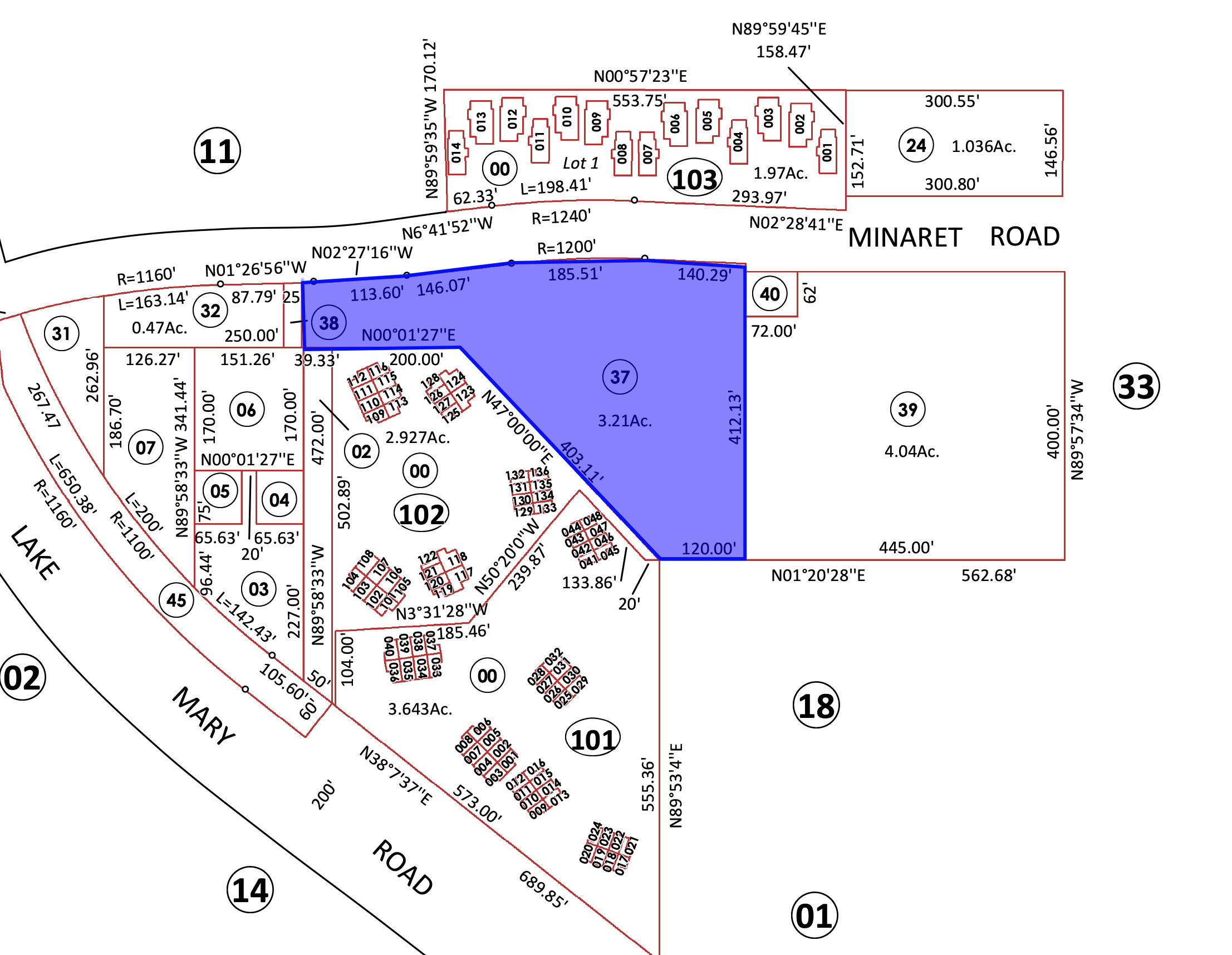
The Minaret Parcel is a 3.3-acre development parcel fronting on one of Mammoth’s busiest thoroughfares. This site is visible from one of the busiest corners in Mammoth Lakes and is a short walk to the “Village at Mammoth”, the most animated tourist destination in Mammoth Lakes.
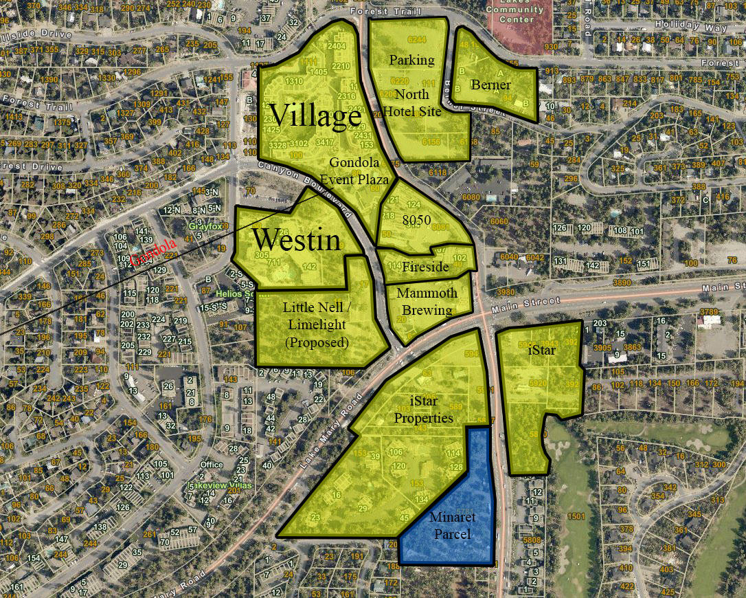
This opportunity is proximate to other existing developments such as Westin Monache, Village Lodging, Events Plaza, 8050, the Village transportation hub, and the proposed Limelight hotel. All of the existing and proposed projects are key elements to finalizing the North Village Specific Plan, bringing a variety of animation to the specific plan. Here is a short video of the property
Investment Highlights
- Zoning allows for 48-rooms per acre.
- Specialty Lodging zoning allows for whole ownership residential, fractional, and hotel product, as well as supporting uses.
- Near the Village at Mammoth, Sierra Star Golf Course, and Mammoth Brewing Company.
- Mammoth Mountain Ski Area consistently realizes some of the greatest average snowfalls of any ski resort in the continental United States.
- Increasing residential property values are tied directly to likely uses under Specialty Lodging.
Property Description
The subject property is a vacant parcel of land located near the southern edge of the North Village Specific Plan in Mammoth Lakes. The property is designated to be a mid-density lodging site, with supporting lodging uses permitted. More about the the Village at Mammoth
The Minaret Property is generally level at its lower half, with an increasingly up-sloped topography at the north western portion of the parcel. The southern portion of the parcel is the most accommodating to development due to its shape and level grade. While the northern portions of the property do have an upsloping topography, these areas would likely afford views of the surrounding mountains if built to maximum height restrictions. Legal description: Por. NE ¼, NW ¼, NW ¼, Sec. 34, T3S, R27E, MDB &M. in the office of the county recorded of Mono county. The assessor parcel number for this property is 033-100-037-000. View our Loopnet Listing Here
The North Village Specific Plan
The North Village Specific Plan is situated in the northwest corridor of the Town of Mammoth Lakes (see Exhibit) and consists of 41 separate parcels, totaling approximately 64 acres. Since the Specific Plan was adopted in 1991, some consolidation of ownership has occurred, but most of the land remains under multiple ownerships. The North Village Specific Plan is located adjacent to Main Street, Lake Mary Road, and Minaret Road. Village at Mammoth
The primary purpose of the North Village Specific Plan is to provide new land use guidelines and development standards for the North Village area, which will enable the development of a cohesive, pedestrian-oriented resort activity node, with supporting facilities to create a year-round focus for visitor activity in the Town of Mammoth Lakes. The North Village Specific Plan provides a mechanism for directing and focusing development in the project
area and will contribute to the overall goal of positioning Mammoth Lakes as a year-round, destination resort community.
The Pedestrian Core area is intended to be a mixed-use village with commercial uses on the ground level and accommodation units on upper
floors. The scale of the individual ground level shops will vary. The village commercial center is designed as a clustering of individual buildings.
Zoning- Specialty Lodging (SL)
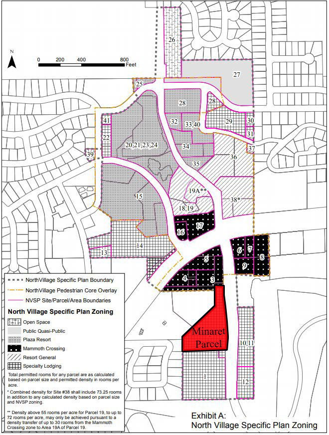
The Minaret Parcel is zoned Specialty Lodging (SL) under the North Village Specific Plan’s most recent revision of January 2014. This designation has been provided for parcels located on the periphery of the North Village Specific Plan, which are physically separated by topography and integrated access from the Pedestrian Core Overlay area. Often these parcels are adjacent to existing residential developments zoned RMF-2 (Residential Multiple Family-2) or RSF (Residential Single Family). Although some flexibility through the use permit process may be provided, this designation promotes land uses such as lodges, bed and breakfast establishments, resort condominiums, European-style inns, employee housing, various residential uses, and public facilities. Twenty-three parcels, totaling 25.85 acres, have been designated under this category. Specialty lodging criteria is described as:
- To provide a transition between North Village’s resort orientation and surrounding residential development.
- To encourage development of employee housing and supporting residential facilities.
- To lower development intensities for parcels located away from the Plaza Resort district and avoid strip commercial development patterns.
Density
Maximum density for parcels within the specialty lodging land use district shall be as follows:
- Specialty Lodging – 48 rooms per acre.
- Density bonuses for the inclusion of affordable housing shall be in accordance with the provisions of the Municipal Code.
Note: For density calculation purposes, the conversions shall apply throughout North Village Specific Plan. One (1) room equals the following:
- 1 hotel room.
- 1 bedroom, loft, or other sleeping area in a residential use.
- 450 square feet of commercial.
Site Coverage
Maximum site coverage, including all buildings, paved site work, or otherwise developed impervious surfaces for Specialty Lodging, is 60%. The Berner Property conceptual plan meets coverage requirements.
Building Area
The maximum building floor area for all developments is 75,000 square feet for the Specialty Lodging district, per acre (excluding structured parking). All developments must also conform to the site coverage and building height requirements.
Building Heights
Specialty Lodging height restrictions allow for a maximum projected height of 50 feet. Building projections above the permitted height may be allowed, provided that a roughly equivalent reduction in the building footprint area above the height is provided below the permitted height, and no more than 50% of the building square footage exceeds the permitted height. All buildings shall be measured to the building roof ridgeline of any section of roof. Roof appurtenances may project above the Projected Height up to 3 feet, subject to Planning Commission approval.
In Specialty Lodging areas, when a substantial number of affordable housing units is provided within a proposed development, a one floor increase (maximum 12 feet in height and equivalent in area to the number of affordable units provided) in building height may be permitted, if all other development standards are met (particularly in relation to shading, solar access and view corridors), subject to the approval of the Planning Commission. A single tower feature on the plaza on both the west and east side of the Pedestrian Core may exceed the maximum projected height and shall not be required to be balanced by a roughly equivalent reduction in building height, subject to the approval through the Design Review process.
Building Setbacks
Setbacks shall be measured from street rights-of-way and from Specific Plan boundaries. For the purpose of measuring setbacks, building heights shall be determined at the intersection of the building, with a vertical plane established by the setback line.
BUILDING SETBACKS FROM ROADWAYS AND SPECIFIC PLAN BOUNDARIES
| Building Height | 0-24’ | 25-34’ | 35-54’ | 55’+ | |
| Forest Trail Street | 10’ | 20’ | 30’ | 40’ | |
| Spec. Plan Boundaries | 10’ | 10’ | 20’ | 40’ | |
| Berner Street | 10’ | 10’ | 20’ | 40’ |


